Station 5: Cottonwood Trail
Methow River Collaborative, 2019
A Methow River Collaborative Project.
Visit Cottonwood Trail on Old Twisp Highway and explore nature through a captivating trail system that is equipped with learning.
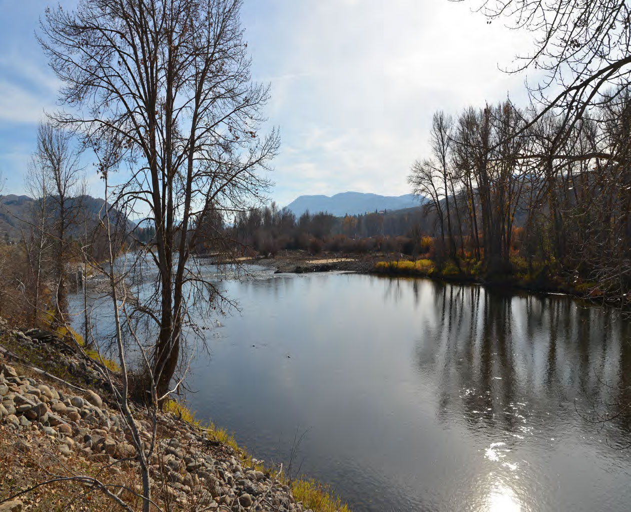
Cottonwood Trail is the perfect place for a picnic and dipping your toes in the cool river. Find numerous interpretive signs placed on several different trail systems throughout the site. Walk all they way to the river to find sandy beaches.
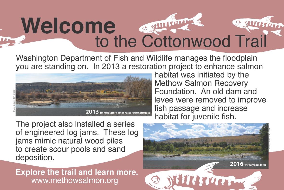
The project was designed to restore floodplain function over a sixty acre site. Project elements included removal of a levee constructed in the 70s to protect former agricultural lands and reestablishing flows to an off-channel wetland pond known locally as Plummer’s Pond.
During high spring flows, the level of the pond fluctuates with the level of the river; the pond level will drop again when the river calms down in the fall. During high water, juvenile fish seek out off-channel habitat like Plummer’s Pond for slower water and abundant food. As flows drop, fish will leave the pond for cooler water in the main channel and the groundwater-fed pools elsewhere in the wetland.
Prior to the project, the off-channel pond was not accessible to fish from the river except during the highest flood flows. Although the pond received inflow from groundwater, culverts under the Old Twisp Highway were not installed to allow rearer flow into the pond, but served as an overflow to prevent damage to the roadway. MSRF removed the undersized culverts and installed two significantly larger arch culverts, allowing for a more natural stream connection. The upper channel is designed to connect only during flood flows, but the lower channel remains connected throughout the spring high flow period. Water flowed through these channels this spring, during moderate high water.
This winter was especially hard on plantings, as extended cold occurred with very little protective snow cover. The cold claimed a few of our plantings, but survival is still well above the permit requirements. We will continue to maintain surviving plants and replace plants lost over the next few years to ensure that the site’s vegetation establishes itself well enough to thrive on its own.
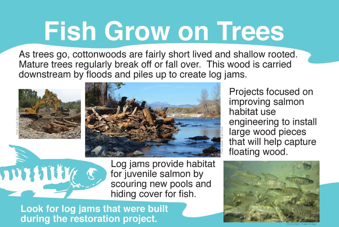
Work on Old Twisp Highway also included increasing the complexity of the side channel through the placement of engineered log jams. If the bed of the river is flat, smooth, and flowing at the same speed, the fish have nowhere to feed or hide. Log jams and other structures in the river support habitat formation through varied flows and depths. Our wood structures appear to be creating nicely varied flow rates, which should help sculpt the channel to create a variety of different depths for fish to rear in year-round.
Find more locations to visit such as the Twisp Ponds Discover Center.
Enjoy the meandering trails set among streams and ponds. Find locally-crafted public art and interpretive stations that serve the dual purpose of education and support for populations of steelhead trout, spring Chinook salmon, and coho salmon.
A Methow River Collaborative Project.
Coordinated by Methow Arts, the Methow River Collaborative is a project of the Department of Ecology, Methow Salmon Recovery Foundation, Bureau of Reclamation and Methow Arts Alliance. True to the Methow, the project uses locally crafted artwork to connect the very things we value about where we live: the river, nature, our community, art and learning. Find more articles, activities and updates HERE.